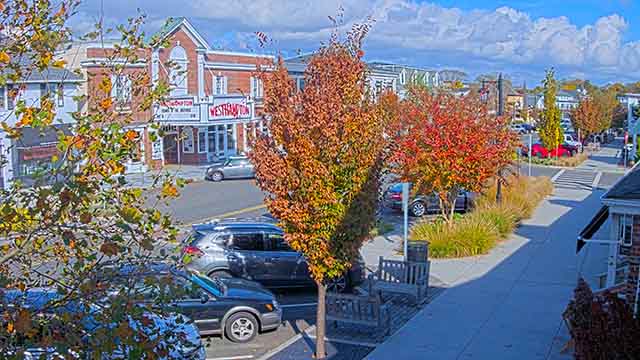
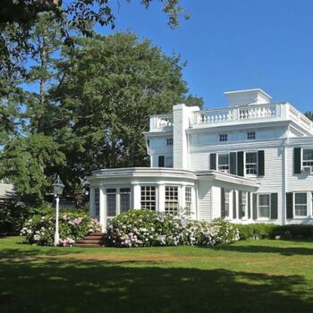
Main Street
Westhampton


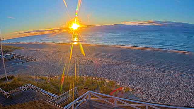
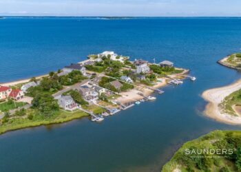
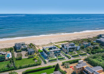
Empire of the Atlantic is a breathtaking taste of what everyone loves about the magic of the waters off the East End, specifically Montauk. Jeff Ragovin, Founder and CEO of Ragovin Ventures, is the executive producer through Bounty Uncharted Productions and assembled a team to bring the project to fruition.

Let’s be honest—there are two types of people in the Hamptons: those who go to Goldberg’s, and those who are wrong. By 8:30 a.m., the line is already forming, a mix of locals, contractors, summer people, and at least one...
Over the past week, there were 18 Listings that went into contract from Westhampton to Montauk. Compared to this same week last year (2025), there were 31 Listings that went into contract. Which is a year over year DECREASE of 42%.

Looking for a summer camp for your little one? The search is over! Hamptons.com has curated a guide of the best camps in the Hamptons! From theater to sports, there are a variety of camps that your kids will love.
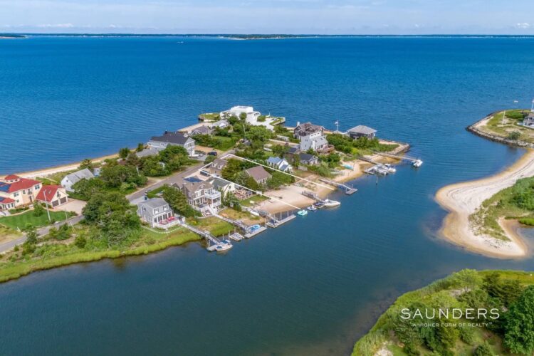
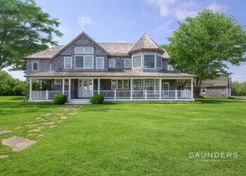
A modern residence located at 24 Rocky Point Road in Shelter Island’s estate section of Greenlawns, represented by Penelope Moore, Licensed Associate Real Estate Broker with Saunders & Associates, is offered for sale and has just been re-priced to $3,290,000...

Philanthropist, author and television host Jean Shafiroff hosted an elegant luncheon at Café Boulud in The Brazilian Court Hotel to honor both Women’s History Month and the work of the New York Women’s Foundation, a charity board she currently serves on and...
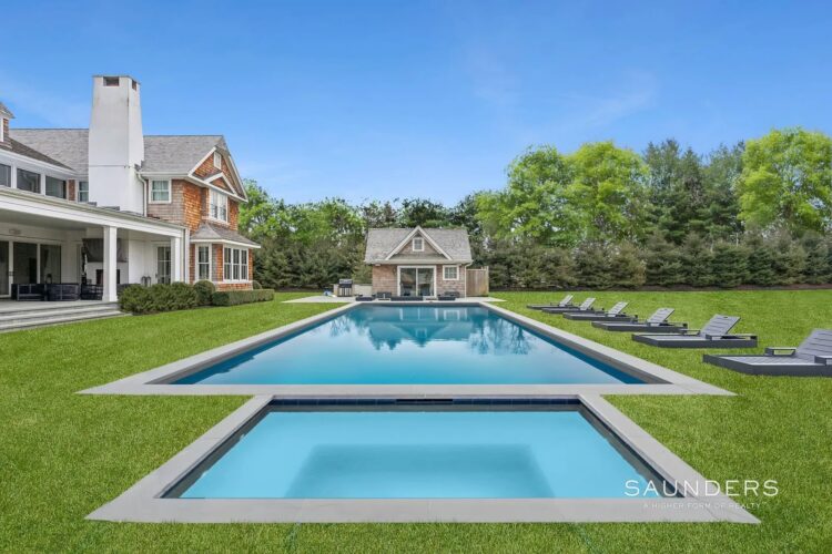
Rarely does a waterfront property come on the market in this desirable Southampton Shores neighborhood, so opportunity knocks for the savvy buyer who wants to reside in a Hamptons Home with extraordinary views over Wooley Pond.
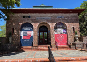
Southampton Arts Center (SAC) is pleased to announce that The Robert David Lion Gardiner Foundation recently awarded a $50,000 grant to SAC to support the upcoming Museum of Democracy Exhibition, THE STORY OF AMERICA: 1776-2026, A CELEBRATION OF FREEDOM AND...
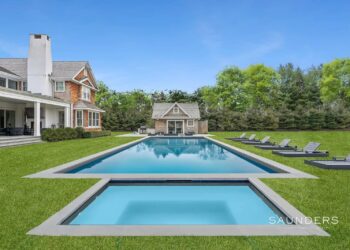
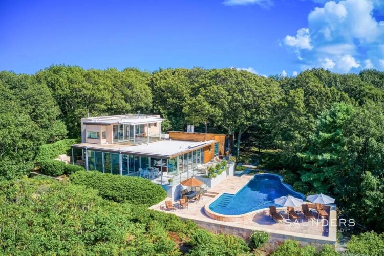
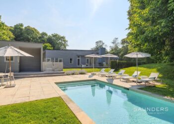
Experience the pinnacle of Hamptons living in this stunning 11,021 +/- SF contemporary masterpiece, completed in 2020. Set on a sprawling 2 acres, this estate offers an unparalleled and discerning rental experience in the Hamptons.
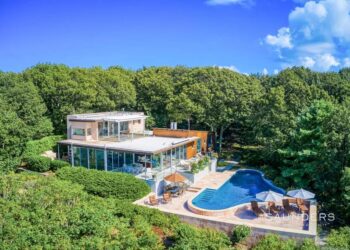
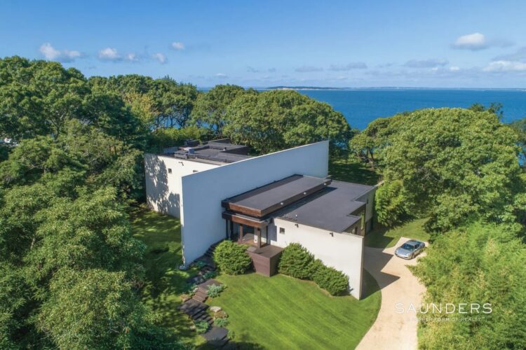
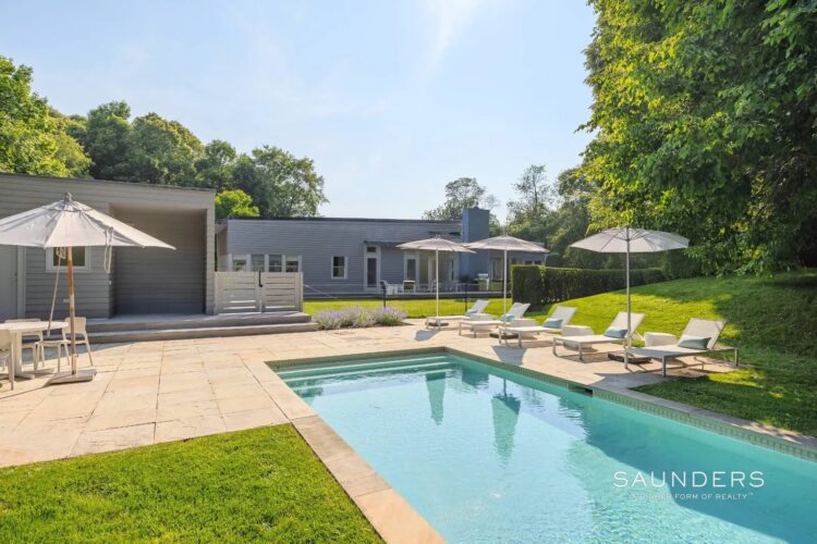
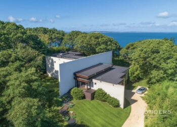
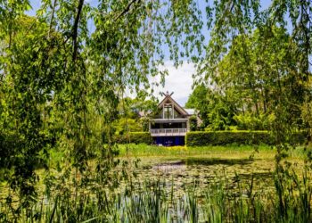
Perched 162 feet above sea level on one of Shelter Island’s highest natural elevations, the modern residence at 42 Prospect Avenue + Part 23 Serpentine Drive, known as “Treetops,” is recognized for both its architecture and its wide-ranging views. Built...
This week, the Miller Fox Team joined and discussed getting ready for the summer season.

Check out the top Hamptons events this April weekend!

A Hamptons estate synonymous with one of reality television’s most recognizable summer backdrops has officially hit the market. The residence at 2136 Deerfield Road in Noyack, featured prominently on Bravo TV’s Summer House, is now being offered for sale, presenting...
I have been studying the numbers for my own edification, and Bridgehampton always catches my attention. When you follow the market closely, you start to see patterns. In Bridgehampton, the pattern is simple. Size. Land. Luxury. Over the past five...

Over the past week, there were 20 Listings that went into contract from Westhampton to Montauk. Compared to this same week last year (2025), there were 14 Listings that went into contract. Which is a year over year INCREASE of 43%.

HamptonsFilm, home of Hamptons International Film Festival, announced today the selected fellows, screenplays, and mentors for the 26th edition of their annual Screenwriters Lab, which will take place April 10-12, 2026.

Set on a perfectly scaled .36-acre parcel, this newly constructed modern barn offers 4,333 +/- SF of thoughtfully curated living space, leading the charge with a new Hamptons design.
LongHouse Reserve, East Hampton’s vital 16-acre sculpture garden and nature sanctuary, will open its 2026 season with a Spring Awakening celebration on April 18 - postponed one month due to the snow and cold temperatures, delaying the annual daffodil blooms....
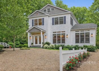
Bathed in natural light, this modern residence delivers thoughtful, convenient amenities while maintaining effortless proximity to pristine ocean beaches and the vibrant villages of East Hampton, Amagansett, and Sag Harbor.

The Parrish Art Museum celebrates the 10th anniversary of ACCESS PARRISH, a pioneering initiative dedicated to making art accessible to visitors of all needs and abilities. Founded in 2016, the program supports year-round community members living with a wide range...
Renovated and Ready for Memorial Day and beyond, A rare opportunity to enjoy the Hamptons Summer in one of the most expansive, South of the Highway properties in Bridgehampton.

Project Most held their annual "Empty Bowls" event on March 8th at the American Legion in Amagansett, featuring delicious soups crafted by local chefs. The community lined up to support a great cause, prompting the chefs to run out of...

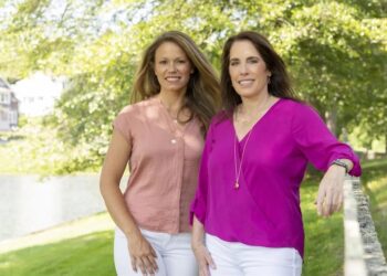
She arrived in New York from europe Two decades ago. Now, she’s shaping culture from the inside, and has made Palm Beach her home. Dee Ocleppo Hilfiger reflects on reinvention, reality TV, creative risk, and why the most powerful women...
Over the past week, there were 18 Listings that went into contract from Westhampton to Montauk. Compared to this same week...
Read moreDetailsA modern residence located at 24 Rocky Point Road in Shelter Island’s estate section of Greenlawns, represented by Penelope Moore,...
Read moreDetailsRarely does a waterfront property come on the market in this desirable Southampton Shores neighborhood, so opportunity knocks for the...
Read moreDetailsExperience the pinnacle of Hamptons living in this stunning 11,021 +/- SF contemporary masterpiece, completed in 2020. Set on a...
Read moreDetailsPerched 162 feet above sea level on one of Shelter Island’s highest natural elevations, the modern residence at 42 Prospect...
Read moreDetailsThis week, the Miller Fox Team joined and discussed getting ready for the summer season.
Read moreDetails

.
.
.
.
.
#shelterisland #treetops #awardwinningmodernhome #luxuryrealestate")
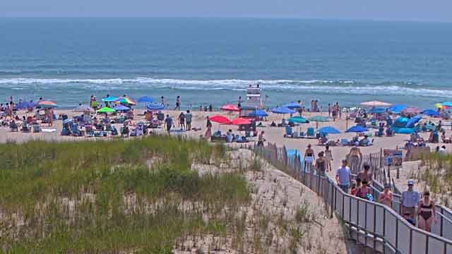
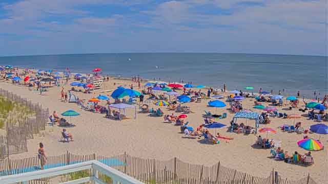
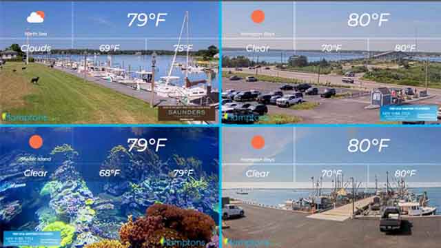
 is currently one of the hottest East End must-sees. Being able to watch the various whales, giant bluefin tuna, marlins, hammerhead sharks, and so many other fish feeding off Montauk in phenomenal drone-captured color footage is spellbinding.
Read the full article at Hamptons.com (Link in Bio)
.
.
.
.
#empireoftheatlantic #montauk #ocean #documentary")
.
🌼 Egg Hunt for Toddlers
📅 Saturday, April 4 | ⏰ 11:45AM–12:30PM
📍 Quogue Wildlife Refuge
Ages 2–4 with a special gift—sign up early!
🌷 Easter Egg Hunt in Amagansett
📅 Saturday, April 4 | ⏰ 12PM–1:30PM
📍 Amagansett Youth Park
Bring a basket and join the fun!
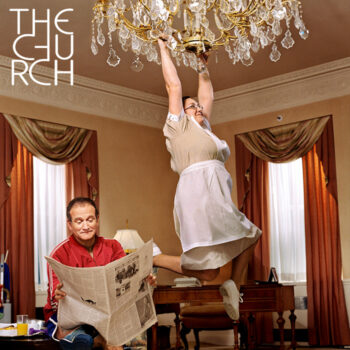
🖼️ A Thousand Words: Opening Reception
📅 Saturday, April 4 | ⏰ 6PM–7:30PM
📍 The Church, Sag Harbor
Preview this spring’s photography exhibition curated by Elisabeth Biondi.
🐰 Southampton Inn Easter Egg Hunt
📅 Sunday, April 5 | ⏰ 10AM–10:30AM
📍 Southampton Inn
Stay after for a classic Easter brunch buffet!
🍳 Easter at The Hampton Maid
📅 Sunday, April 5 | ⏰ 8AM–3PM
📍 Hampton Bays
Festive brunch, Easter Bunny visit & egg hunt for kids.
🥂 Easter Brunch at Nick & Toni’s
📅 Sunday, April 5 | ⏰ 11:30AM–2:30PM
📍 East Hampton
Celebrate with a special $95 prix-fixe brunch.
Check out more events at Hamptons.com (Link in bio)
#easter #hamptons #egghunt #art #sagharbor")

#hamptons #montauk #stpatricksday #hike #concert egghunt")

.
.
.
.
#hamptonsfilm #film #palmbeach #screening #colonyhotel")